


Wikiloc - Trails of the World
4.5402.00 Reviews
App Specs
- Version
- Varies with Device
- Updated On
- License
- Free
- Downloads
- 10,000,000+
- Developer
- Wikiloc Outdoor
- Categories
- Maps & Navigation
- Platform
- Android, iOS
Screenshots
 Analysis by AppCompare
Before choosing a route, I’d treat Wikiloc as a place to research and compare outings, not as a promise that a trail will suit me simply because it appears on a map. A route recorded by another person can be an excellent starting point, but the description, photos, and comments still need to be weighed against my own fitness, the day’s conditions, and how comfortable I am navigating outdoors. That small shift in expectations makes the app more useful: it helps me make a better plan rather than making the decisions for me.
What I would check before heading out
For a first outing, I’d search close to home and compare a few routes instead of picking the first appealing line. Distance alone does not tell the whole story. I look for a description that explains what the route is like, photos that give me a sense of the terrain, and recent-looking community feedback where available. If those details leave me unsure about a section, I would choose a more familiar or straightforward route rather than treating the app’s difficulty label as a guarantee.
I’d also think about the practical shape of the day: where I can start, whether the route is a loop or an out-and-back, and how much time I can comfortably spend outside. A route that looks manageable on a screen can feel different once I account for breaks, weather, or a slower pace. Wikiloc is most helpful when I use it to narrow the options and then make a sensible choice for the people actually going.
A calm first setup and a useful first outing
My advice to a new user is to keep the first session simple. Browse an area you already know, open a few nearby routes, and get familiar with the map and route information before relying on them somewhere unfamiliar. That gives me a chance to learn how the app presents trails without also having to solve a navigation problem on the move. I’d save the more ambitious exploration for after I know what information I personally find useful.
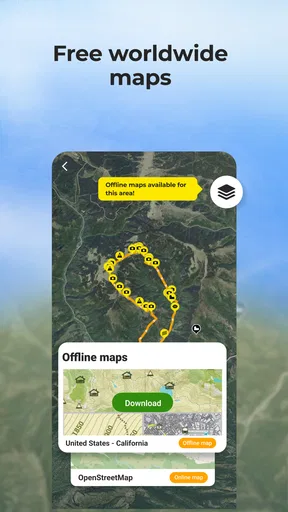
Before leaving, I’d make sure the route I chose is available for the kind of use I expect, especially if I may lose mobile coverage. The important practical point is to prepare while I still have a connection and time to check my choice. Offline navigation can be valuable outdoors, but downloading or opening the relevant material at the last minute is a poor substitute for planning. I’d also bring ordinary essentials and keep a backup sense of where I am; a phone app should support good judgment, not replace it.
A realistic first success could be a short local walk on a route another user has shared. I can review its notes and pictures at home, follow the mapped path, and record my own outing if I want a personal track to look back on. Even if I do not publish anything, that first trip helps me learn whether I prefer discovering other people’s routes or using Wikiloc mainly to document places I already visit.
Where the community helps—and where it needs judgment
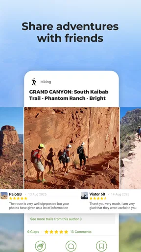
The community is a real strength because a trail is more tangible when I can see what other people noticed along it. Photos can reveal the character of a path better than a bare line on a map, while written impressions can help me decide whether the outing sounds enjoyable. Still, those details describe somebody else’s experience at a particular time. A path can change, conditions can differ, and a route that felt easy to one person may not feel easy to me.
Worth Reading Before You Choose

Baby Panda World Brings Quick Play to Modern Phones, but Its Game Library Feels Busy

ESPN’s Live Game View Makes Following Close Games Easier

QuizzLand Review: A Good Fit for Short Trivia Breaks, Not Every Player

Basketball Stars: Multiplayer Is Fast, but Can It Recover When Matches Go Wrong?

WEBTOON Turns Phone Updates Into a Better Reading Routine

Link to Windows Runs on Shared Habits, Not Social Feeds
That is why I would use several clues together rather than treating one review as decisive. If the route description, map, and community impressions all seem consistent, I feel more comfortable considering it. If they leave important questions unanswered, I would look for another option or gather local information before setting off. The app can surface possibilities, but it cannot inspect the trail on the day I arrive.
Recording a route has a different kind of value from following one. On a familiar walk, tracking can help me remember the path and keep a record of where I went; waypoints and photos can make that record more meaningful than a line alone. I would decide before starting whether I want to share the result. A personal record and a public contribution are not the same thing: sharing is useful to the community, but it also means taking care that my notes are clear and that I am comfortable making the route visible.
Who is likely to enjoy it
I’d recommend Wikiloc to people who like choosing their own outdoor plans and want inspiration beyond the routes they already know. It suits hikers and cyclists especially well when they enjoy comparing paths, reading other people’s impressions, and keeping a record of their own outings. It can also be useful to someone who travels and wants to explore on foot or by bike, provided they do the same careful route checks they would at home.
It is less suited to someone who wants a completely hands-off guide or assumes that a popular route will automatically be safe and appropriate. If I need turn-by-turn directions for ordinary city driving, a conventional navigation app is a more natural fit. If I am entering remote or demanding terrain, I would not make a phone app my only navigation plan. Wikiloc can help me discover and follow routes, but it does not remove the need to understand the outing and prepare for it.
Getting to Know Wikiloc
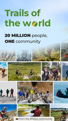
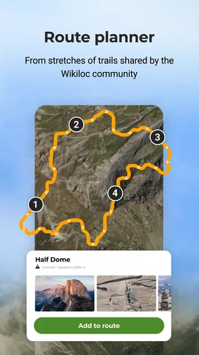
First things first, let's talk about what this app actually does. Wikiloc is essentially a platform where outdoor enthusiasts can discover and share trails. Think of it as a global community of adventurers, each contributing their favorite paths for others to enjoy. From hiking and biking to kayaking and even paragliding, the variety is immense.
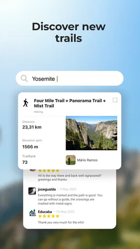
After downloading the app, I was blown away by the sheer number of trails available. You can zoom in on any part of the world map and find trails ranging from easy to expert, complete with detailed descriptions, photos, and user reviews. It's like having an endless supply of trail options at your fingertips.
Features That Stand Out
One of my favorite features is the offline maps. Let's be honest, cell service can be spotty in the great outdoors, so having the ability to download maps and use them offline is a game-changer. No more getting lost in the middle of nowhere!
The interface is super intuitive, making it easy to search and filter trails based on distance, difficulty, and type of activity. Plus, the community-driven aspect means you get real insights from people who have actually walked the walk. The user reviews and photos help you know exactly what to expect.
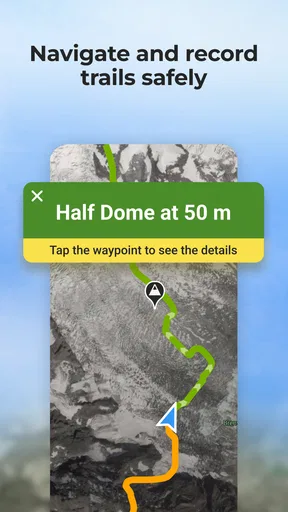
Another cool feature is the ability to record your own trails. You can track your route, add waypoints, and even take geotagged photos along the way. Once you've completed your adventure, you can share it with the community. It's a great way to contribute and maybe even inspire someone else to follow in your footsteps.
My Personal Experience
So, what was it like actually using Wikiloc? I decided to test it out on a weekend hike. I picked a trail not too far from home, and thanks to the app, I was well-prepared. The trail description was spot-on, and the offline map ensured I stayed on course despite my phone's GPS dropping out at times.
As I walked, I recorded my trail, snapping photos along the way. The app made it easy to add notes at each waypoint, so I could remember exactly where I saw that amazing view or interesting wildlife. By the end of the hike, I felt like I had a complete snapshot of my adventure, ready to share with others.
Why You Should Try Wikiloc
If you're an outdoor enthusiast, this app is a must-try. The community aspect adds a layer of trust and reliability, making it easier to explore new places with confidence. Whether you're planning a local day trip or dreaming of an international escapade, Wikiloc is like having a treasure map to the world's best trails.
And for those who enjoy documenting their journeys, the trail recording feature is a fantastic way to keep track of all your adventures. Share them with the community or keep them as personal mementos—either way, it's a rewarding experience.
In a world where technology often keeps us indoors, Wikiloc - Trails of the World encourages us to step outside, explore, and connect with nature. I can't recommend it enough for anyone looking to add a bit of adventure to their life. So, lace up your hiking boots, grab your phone, and let's hit the trails!
How it fits among navigation apps
What separates Wikiloc from the navigation app I reach for in town is its emphasis on outdoor routes contributed by people who have taken them. A standard map is often quicker for finding a street address or checking a drive, while Wikiloc makes more sense when the question is, “What could I walk or ride here, and what did the route feel like for someone else?” Those are different jobs, so I would keep the tools I need rather than expect one app to replace every map.
For a casual outing, that discovery angle is the useful part: I can browse trails and use other people’s route details to shape a plan. For navigation in unfamiliar or challenging country, though, I would want more than a crowd-sourced route on a phone. I would prepare an appropriate backup and avoid assuming that a GPS trace alone tells me whether a path is passable, suitable, or safe today.
Small habits that make the app more useful
One practical habit is to inspect the route before going out, then check it again once I have decided on the day’s plan. That gives me a chance to notice whether I chose a route for the right activity and whether its description matches what I want from the outing. Another is to use waypoints with a purpose when recording: a note about a junction or a photo of a viewpoint is more helpful to my future self than adding markers without context.
I would also avoid turning a good-looking route into a rigid itinerary. If the path or conditions do not match what I expected, I would rather turn back or choose a safer option than press on just to complete a track. Wikiloc’s value is in making exploration easier to plan and remember; it should not pressure me into finishing a route that no longer feels right.
The app is free to start, and its audience is broad: it is rated for Everyone and has an average rating of 4.5 from around 144,000 ratings, with more than 10 million installs. Wikiloc Outdoor develops it, and optional in-app purchases range from $0.99 to $19.99 per item. I’d consider those details when deciding whether to explore the free experience first or pay for something I know I need, rather than assuming every useful feature is included at no cost.
Overall, I see Wikiloc as a particularly appealing companion for curious walkers and riders who want to find routes, learn from other users, and keep a record of their own adventures. It asks a little judgment from the person using it: check the route, prepare before coverage becomes an issue, and treat community reports as helpful context rather than guarantees. If that sounds like a reasonable way to explore, it is an enjoyable place to begin—and a practical one to return to when familiar paths start feeling too familiar.
Pros
- Extensive trail database worldwide.
- User-friendly interface for easy navigation.
- Offline maps for remote locations.
- Community-driven with real user reviews.
- Track your own routes effortlessly.
Cons
- Limited free features without subscription.
- Occasional GPS inaccuracies reported.
- Map updates can be slow at times.
- Requires internet for full functionality.
- Some trails lack detailed information.
FAQs for Wikiloc - Trails of the World
What is Wikiloc - Trails of the World used for?
Wikiloc is an app designed for outdoor enthusiasts who enjoy activities like hiking, cycling, running, and more. It offers a vast collection of trails from around the world, allowing users to discover new routes, track their own adventures, and share them with a community of like-minded individuals.
Is Wikiloc free to use, and what features are available in the premium version?
While Wikiloc offers a free version with basic features like browsing and saving trails, the premium version, known as Wikiloc Premium, provides additional benefits. These include offline maps, live tracking, weather forecasts, and advanced search filters, which enhance the overall outdoor experience.
How does Wikiloc ensure the accuracy and safety of its trails?
Wikiloc relies on a community-driven approach, where users can upload, rate, and review trails. This feedback system helps ensure the accuracy and safety of routes. Additionally, users can view trail details, including difficulty levels and elevation profiles, to better prepare for their adventures.
Can I use Wikiloc without an internet connection?
Yes, Wikiloc allows you to download trails and maps for offline use, which is particularly useful in remote areas with limited connectivity. However, this feature is only available in the premium version, making it a valuable investment for avid adventurers who frequently explore areas without reliable internet access.
What devices are compatible with Wikiloc?
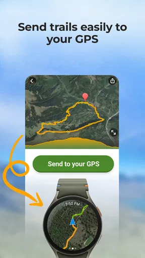
Wikiloc is compatible with both Android and iOS devices, making it accessible to a wide range of users. It also integrates with various GPS devices, allowing for seamless tracking and sharing of trails. This compatibility ensures that users can enjoy the app’s features regardless of their preferred technology.


